- Added LOWER WHEATFIELDS, AZ to cart. View cart.
- Added TROUT CREEK BUTTE, OR to cart. View cart.
- Added HOPE POND, TX to cart. View cart.
- Added EAGLE ROCK, NV to cart. View cart.
- Added SCRANTON, NC to cart. View cart.
- Added KELLER BUTTE, WA to cart. View cart.
- Added WATERLOO, CA to cart. View cart.
- Added DEVILS GRAVEYARD, OR to cart. View cart.
- Added WOLF CREEK, CA to cart. View cart.
- Added EFFINGHAM, IL HISTORICAL MAP GEOPDF 15X1 to cart. View cart.
- Added MOUNT PLEASANT, AR to cart. View cart.
- Added JOHNSTON CITY, IL HISTORICAL MAP GEOPDF to cart. View cart.
- Added ISLAND POND, ME to cart. View cart.
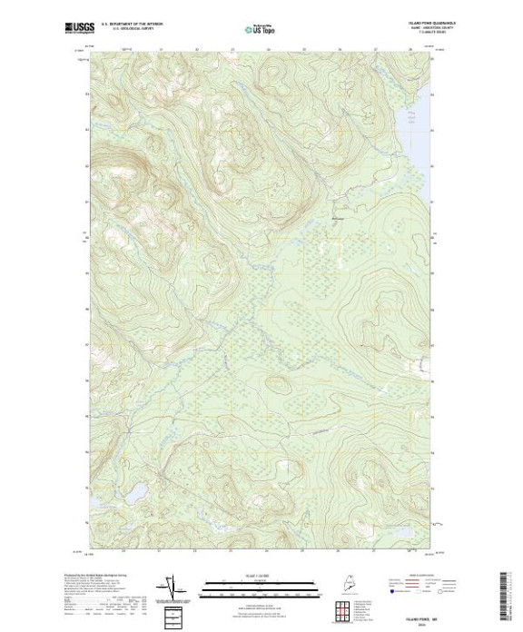

Product Details
- Product Number
- 811312
- Scale
- 1:24,000
- Version Date
- 01/01/2024
- Regions
- ME
- Countries
- USA
- Media
- Paper
- Format
- Flat
- Digital Reproduction
- Yes
Additional Details
- Description
- ISLAND POND, ME TNM GEOSPATIAL PDF 7.5X7.5 GRID 24000
- Survey Date
- 2024
- Print Date
- 2024
- Height In Inches
- 29.000
- Length In Inches
- 24.000
- Boundary Type
- Quadrangle
- Pieces
- 1
Related Items