
- Added JAYPE, ID to cart. View cart.
- Added MIDVALE, ID to cart. View cart.
- Added GRACE POWER PLANT, ID HISTORICAL MAP GEO to cart. View cart.
- Added SINKER BUTTE, ID HISTORICAL MAP GEOPDF 7 to cart. View cart.
- Added SOUTHEAST PONTIAC, IL to cart. View cart.
- Added LICK CREEK, IL HISTORICAL MAP GEOPDF 7.5 to cart. View cart.
- Added HOG CREEK, ID to cart. View cart.
- Added EAST OF CAMBRIDGE, ID to cart. View cart.
- Added LICK CREEK, IL to cart. View cart.
- Added MURDOCK, IL to cart. View cart.
- Added HILL PASTURE, ID to cart. View cart.
- Added BURNSIDE, MI to cart. View cart.
- Added ASHLAND, IL HISTORICAL MAP GEOPDF 7.5X7. to cart. View cart.
- Added JUMPOFF HILL, ID to cart. View cart.
- Added HOT SPRINGS CREEK RESERVOIR, ID to cart. View cart.
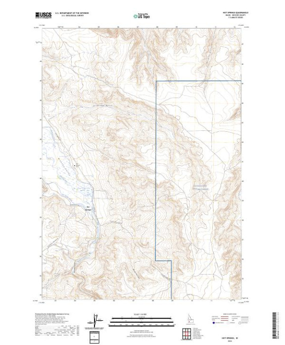

Product Details
- Product Number
- 809248
- Scale
- 1:24,000
- Version Date
- 01/01/2024
- Regions
- ID
- Countries
- USA
- Media
- Paper
- Format
- Flat
- Digital Reproduction
- Yes
Additional Details
- Description
- HOT SPRINGS, ID TNM GEOSPATIAL PDF 7.5X7.5 GRID 24000
- Survey Date
- 2024
- Print Date
- 2024
- Height In Inches
- 29.000
- Length In Inches
- 24.000
- Boundary Type
- Quadrangle
- Pieces
- 1
Related Items
HOT SPRINGS CREEK RESERVOIR, ID TNM GEOSPATIAL PDF 7.5X7.5 GRID 24000