- Added CENTRAL PLAINS STATES, US to cart. View cart.
- Added DIXIE, ID to cart. View cart.
- Added NULATO C-6, AK to cart. View cart.
- Added MCGRATH C-4, AK to cart. View cart.
- Added ATWATER, CA to cart. View cart.
- Added OPHIR D-2, AK to cart. View cart.
- Added HURRICANE DECK, CA to cart. View cart.
- Added SHADED RELIEF MAP CHRYSE REGION OF MARS to cart. View cart.
- Added NULATO D-1, AK to cart. View cart.
- Added CORNPLANTER ROADLESS-MINERAL, PA to cart. View cart.
- Added MCGRATH D-5, AK to cart. View cart.
- Added STEWART FLAT, ID to cart. View cart.
- Added OPHIR A-2, AK to cart. View cart.
- Added DANIELS, ID to cart. View cart.
- Added NORWALK NORTH - AEROMAGNETIC, CT to cart. View cart.
- Added MOUNT HARMSWORTH, ANTARCTICA to cart. View cart.
- Added GLAMIS, CA to cart. View cart.

Product Details
- Product Number
- 44111
- Scale
- 1:24,000
- Alternate ID
- TCA0898
- ISBN
- 978-0-607-08834-2
- Version Date
- 01/01/1979
- Regions
- CA
- Countries
- USA
- Media
- Paper
- Format
- Flat
- Digital Reproduction
- Yes
Additional Details
- Description
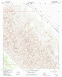
- GLAMIS, CA HISTORICAL MAP GEOPDF 7.5X7.5 GRID 24000-SCALE 1955
- Survey Date
- 1937
- Print Date
- 1983
- Height In Inches
- 26.900
- Length In Inches
- 21.500
- Boundary Type
- Quadrangle
- Two Sided
- No
- Pieces
- 1
- Languages
- English
Related Items