- Added FLATIRON MOUNTAIN, MT to cart. View cart.
- Added TIFFIN NORTH, OH to cart. View cart.
- Added PETROGLYPH CANYON, CA to cart. View cart.
- Added TYRONE, NM to cart. View cart.
- Added YSLETA, TX to cart. View cart.
- Added RED KNOLL, AZ to cart. View cart.
- Added DOROTHY, WV to cart. View cart.
- Added TABLE MOUNTAIN, CO-WY to cart. View cart.
- Added WOODED ISLAND, WA to cart. View cart.
- Added ENGLISH PEAK, CA to cart. View cart.
- Added HILLSBORO, OR to cart. View cart.
- Added SUSQUEHANNA, PA-NY to cart. View cart.
- Added GOVERNMENT WASH, NV to cart. View cart.
- Added DE CHAN ALL DEP OH V KY 57, KY to cart. View cart.
- Added JOSHUA TREE NORTH, CA to cart. View cart.
- Added MOORESVILLE, NC to cart. View cart.
- Added SAINT CHARLES BAY, TX to cart. View cart.
- Added MOUNT KATMAI C-2, AK to cart. View cart.
- Added EVERETT, WA to cart. View cart.
- Added DOYLE HILL, NM-TX to cart. View cart.
- Added SEA ISLAND, GA HISTORICAL MAP GEOPDF 7.5 to cart. View cart.
- Added PORT ARTHUR SOUTH, TX-LA HISTORICAL MAP to cart. View cart.
- Added KNAPP CREEK, NY to cart. View cart.
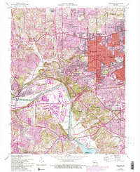
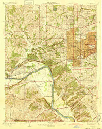
- Added KIRKWOOD, MO to cart. View cart.


Product Details
- Product Number
- 321740
- Scale
- 1:24,000
- Version Date
- 01/01/1940
- Regions
- MO
- Countries
- USA
- Media
- Paper
- Format
- Flat
Additional Details
- Description
- KIRKWOOD, MO HISTORICAL MAP GEOPDF 7.5X7.5 GRID 24000-SCALE 1940
- Survey Date
- 1933
- Height In Inches
- 25.100
- Length In Inches
- 19.900
- Boundary Type
- Quadrangle
- Pieces
- 1
Related Items
KIRKWOOD, MO HISTORICAL MAP GEOPDF 7.5X7.5 GRID 24000-SCALE 1940