


Product Details
- Product Number
- 66688
- Scale
- 1:24,000
- Alternate ID
- TMN0250
- ISBN
- 978-0-607-90722-3
- Version Date
- 01/01/1996
- Regions
- MN
- Countries
- USA
- Media
- Paper
- Format
- Flat
- Digital Reproduction
- Yes
Additional Details
- Description
- ORTHOPHOTOMAP IS REPLACED BY THE TOPO AS OF 01-05-99
- Survey Date
- 1996
- Print Date
- 1998
- Height In Inches
- 27.100
- Length In Inches
- 22.100
- Boundary Type
- Quadrangle
- Two Sided
- No
- Pieces
- 1
- Languages
- English
Related Items
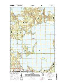
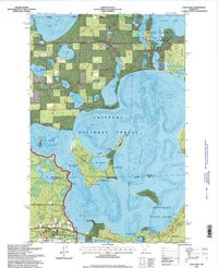
CASS LAKE, MN HISTORICAL MAP GEOPDF 7.5X7.5 GRID 24000-SCALE 1996
