
- Added LA FRANCE, SC to cart. View cart.
- Added VARNEY, KY to cart. View cart.
- Added BUCKHORN, KY to cart. View cart.
- Added PURGATORY CANYON, AZ-UT HISTORICAL MAP G to cart. View cart.
- Added MATFIELD GREEN, KS to cart. View cart.
- Added OLMSTEAD, KY to cart. View cart.
- Added FRIENDSHIP, OH-KY to cart. View cart.
- Added JEFFERSONTOWN, KY to cart. View cart.
- Added KNIGHT, LA HISTORICAL MAP GEOPDF 7.5X7.5 to cart. View cart.
- Added SONSELA BUTTES, AZ-NM HISTORICAL MAP GEO to cart. View cart.
- Added LEOTI, KS HISTORICAL MAP GEOPDF 7.5X7.5 to cart. View cart.
- Added EUBANK, KY HISTORICAL MAP GEOPDF 7.5X7.5 to cart. View cart.
- Added MASON, KY to cart. View cart.
- Added PINE HOLLOW CANYON, UT-AZ to cart. View cart.
- Added BENHAM, KY-VA to cart. View cart.
- Added RUSH, KY HISTORICAL MAP GEOPDF 7.5X7.5 G to cart. View cart.
- Added SONORA, KY to cart. View cart.
- Added MOUNT VERNON, IN-KY to cart. View cart.
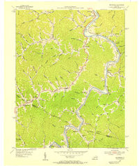
- Added RICHARDSON, KY to cart. View cart.


Product Details
- Product Number
- 262354
- Scale
- 1:24,000
- Version Date
- 01/01/1954
- Regions
- KY
- Countries
- USA
- Media
- Paper
- Format
- Flat
Additional Details
- Description
- RICHARDSON, KY HISTORICAL MAP GEOPDF 7.5X7.5 GRID 24000-SCALE 1954
- Survey Date
- 1954
- Print Date
- 1967
- Height In Inches
- 27.000
- Length In Inches
- 22.000
- Boundary Type
- Quadrangle
- Pieces
- 1
Related Items
RICHARDSON, KY HISTORICAL MAP GEOPDF 7.5X7.5 GRID 24000-SCALE 1954
