- Added WICKAHONEY CROSSING, ID to cart. View cart.
- Added ERIE NW, IL HISTORICAL MAP GEOPDF 7.5X7. to cart. View cart.
- Added HARTLEY PEAK, ID to cart. View cart.
- Added THORN CREEK RESERVOIR, ID to cart. View cart.
- Added CLEAR LAKE, IL to cart. View cart.
- Added JUMPOFF HILL, ID to cart. View cart.
- Added ATHENS, IL to cart. View cart.
- Added SWAN VALLEY, ID to cart. View cart.
- Added FAIRDALE, IL to cart. View cart.
- Added BONDVILLE, IL to cart. View cart.
- Added PINE CREEK RAPIDS, ID to cart. View cart.
- Added ULYSSES MOUNTAIN, ID to cart. View cart.
- Added HOT SPRINGS, ID to cart. View cart.
- Added MURPHY, ID to cart. View cart.
- Added ELIZABETH LAKE, ID to cart. View cart.


Product Details
- Product Number
- 54587
- Scale
- 1:24,000
- Alternate ID
- TID0436
- ISBN
- 978-0-607-88244-5
- Version Date
- 01/01/1994
- Regions
- ID
- Countries
- USA
- Media
- Paper
- Format
- Flat
- Digital Reproduction
- Yes
Additional Details
- Description
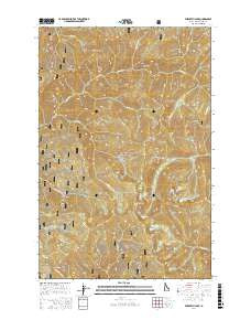
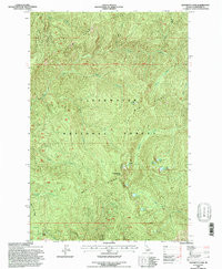
- ELIZABETH LAKE, ID HISTORICAL MAP GEOPDF 7.5X7.5 GRID 24000-SCALE 1994
- Survey Date
- 1994
- Print Date
- 1997
- Height In Inches
- 26.900
- Length In Inches
- 22.100
- Boundary Type
- Quadrangle
- Two Sided
- No
- Pieces
- 1
- Languages
- English
Related Items

ELIZABETH LAKE, ID HISTORICAL MAP GEOPDF 7.5X7.5 GRID 24000-SCALE 1994