

Product Details
- Product Number
- 35638
- Series
- 66162-A1-TF-250-00
- Scale
- 1:250,000
- Alternate ID
- TAK1463
- ISBN
- 978-0-607-02391-6
- Version Date
- 01/01/1951
- Regions
- AK
- Countries
- USA
- Media
- Paper
- Format
- Flat
Additional Details
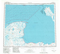
- Description
- KOTZEBUE, AK HISTORICAL MAP GEOPDF 1X3 GRID 250000-SCALE 1951
- Survey Date
- 1951
- Print Date
- 1982
- Height In Inches
- 23.080
- Length In Inches
- 25.500
- Boundary Type
- Quadrangle
- Two Sided
- No
- Pieces
- 1
- Languages
- English
Related Items
