- Added BRUSH LAKE, CA to cart. View cart.
- Added CORDELL, OK HISTORICAL MAP GEOPDF 15X15 to cart. View cart.
- Added MYERS, MT to cart. View cart.
- Added CALDWELL, ID to cart. View cart.
- Added CAINHOY, SC to cart. View cart.
- Added BEACON BEACH, FL to cart. View cart.
- Added HOAGLIN, CA HISTORICAL MAP GEOPDF 30X30 to cart. View cart.
- Added HARTFORD NORTH, CT to cart. View cart.
- Added LEBANON - AEROMAGNETIC, PA to cart. View cart.
- Added GRAVEYARD HILL, MT to cart. View cart.
- Added WILLAMETTE NF - MCKENZIE RIVER DISTRICT to cart. View cart.
- Added WESTERN ISLES DERNIERES, LA to cart. View cart.
- Added WALLOWA-WHITMAN NF, OR to cart. View cart.
- Added MONOMOY POINT, MA to cart. View cart.
- Added MILES CITY, FL to cart. View cart.
- Added POMEROY, TX to cart. View cart.
- Added CITY POINT NE, WI to cart. View cart.
- Added GORDON, WI to cart. View cart.
- Added OWYHEE RIDGE, OR to cart. View cart.
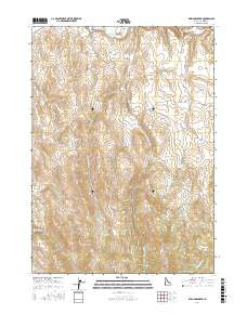
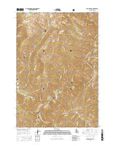
- Added WILLIAMS PEAK, ID to cart. View cart.
Product Details
- Product Number
- 752844
- Scale
- 1:24,000
- Version Date
- 01/01/2017
- Regions
- ID
- Countries
- USA
- Media
- Paper
- Format
- Flat
- Digital Reproduction
- Yes
Additional Details
- Description
- WILLIAMS PEAK, ID TNM GEOPDF 7.5X7.5 GRID 24000
- Survey Date
- 2017
- Print Date
- 2017
- Height In Inches
- 29.000
- Length In Inches
- 24.000
- Boundary Type
- Quadrangle
- Pieces
- 1
Related Items