- Added WHITTEMORE RIDGE, CA HISTORICAL MAP GEOP to cart. View cart.
- Added COLLBRAN, CO HISTORICAL MAP GEOPDF 7.5X7 to cart. View cart.
- Added ANTELOPE MESA, CO to cart. View cart.
- Added COTOPAXI, CO HISTORICAL MAP GEOPDF 7.5X7 to cart. View cart.
- Added CLIMAX, CO to cart. View cart.
- Added CHESTER, CO HISTORICAL MAP GEOPDF 7.5X7. to cart. View cart.
- Added CHEYENNE WELLS, CO to cart. View cart.
- Added HAMM CANYON, CO to cart. View cart.
- Added DEORA, CO HISTORICAL MAP GEOPDF 7.5X7.5 to cart. View cart.
- Added COALMONT, CO HISTORICAL MAP GEOPDF 7.5X7 to cart. View cart.
- Added FAWN CREEK, CO to cart. View cart.
- Added BYERS, CO to cart. View cart.
- Added BLACK FOREST, CO to cart. View cart.
- Added HILLSIDE, CO to cart. View cart.
- Added TOMBSTONE MOUNTAIN, CA to cart. View cart.
- Added CHEYENNE WELLS SW, CO to cart. View cart.
- Added COALDALE, CO to cart. View cart.
- Added EUREKA CREEK NORTH, CO to cart. View cart.
- Added ECKLEY, CO to cart. View cart.
- Added ELDER, CO to cart. View cart.
- Added DURKEE CREEK NE, CO-KS to cart. View cart.
- Added CORCORAN PEAK, CO to cart. View cart.


Product Details
- Product Number
- 274975
- Scale
- 1:24,000
- Version Date
- 01/01/1968
- Regions
- CO
- Countries
- USA
- Media
- Paper
- Format
- Flat
Additional Details
- Description
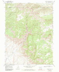
- CORCORAN PEAK, CO HISTORICAL MAP GEOPDF 7.5X7.5 GRID 24000-SCALE 1968
- Survey Date
- 1968
- Print Date
- 1972
- Height In Inches
- 27.200
- Length In Inches
- 22.100
- Boundary Type
- Quadrangle
- Pieces
- 1
Related Items