- Added MANISTEE RIVER RECONNAISSANCE, MI to cart. View cart.
- Added WILLOWS CAMP, AZ to cart. View cart.
- Added LAKE STEPHENSON, TX to cart. View cart.
- Added BIRNEY SW, MT to cart. View cart.
- Added NEW AUGUSTA, MS HISTORICAL MAP GEOPDF 7. to cart. View cart.
- Added LITTLE BIGELOW MOUNTAIN, ME HISTORICAL M to cart. View cart.
- Added ANGLEWORM LAKE, MN to cart. View cart.
- Added KELLOG WELL, NM to cart. View cart.
- Added CLINTWOOD, VA-KY to cart. View cart.
- Added NORTH CANYON, ID to cart. View cart.
- Added TOVAR MESA WEST, AZ HISTORICAL MAP GEOPD to cart. View cart.
- Added EMIGRANT PEAK, NV to cart. View cart.
- Added EAST OF DEEM CITY, FL to cart. View cart.
- Added KINGSTON, NM to cart. View cart.
- Added MONTOUR, ID to cart. View cart.
- Added TECATE, CA HISTORICAL MAP GEOPDF 7.5X7.5 to cart. View cart.
- Added PADDOCK VALLEY RESERVOIR, ID to cart. View cart.
- Added WALLACE, AL to cart. View cart.
- Added ROSITA, CO HISTORICAL MAP GEOPDF 7.5X7.5 to cart. View cart.
- Added MCCLELLAND, IA to cart. View cart.
- Added TULE WASH, AZ to cart. View cart.

Product Details
- Product Number
- 41860
- Scale
- 1:24,000
- Alternate ID
- TAZ1419
- ISBN
- 978-0-607-07255-6
- Version Date
- 01/01/1968
- Regions
- AZ
- Countries
- USA
- Media
- Paper
- Format
- Flat
- Digital Reproduction
- Yes
Additional Details
- Description
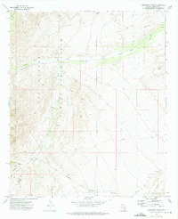
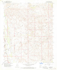
- TAH CHEE WASH, AZ HISTORICAL MAP GEOPDF 7.5X7.5 GRID 24000-SCALE 1968
- Survey Date
- 1968
- Print Date
- 1972
- Height In Inches
- 26.900
- Length In Inches
- 21.600
- Boundary Type
- Quadrangle
- Two Sided
- No
- Pieces
- 1
- Languages
- English
Related Items
TAH CHEE WASH, AZ HISTORICAL MAP GEOPDF 7.5X7.5 GRID 24000-SCALE 1968