- Added TALKEETNA B-2, AK to cart. View cart.
- Added SHADED RELIEF MISHARU QUAD GANYMEDE to cart. View cart.
- Added GEOLOGIC MAP LAVANIA PLANITIA QUAD VENUS to cart. View cart.
- Added BETTLES D-5, AK to cart. View cart.
- Added MARSHALL C-3, AK to cart. View cart.
- Added REPORTS AND MAPS OF USGS to cart. View cart.
- Added CRAIG L-179, US to cart. View cart.
- Added WILDCAT RANCH, AZ to cart. View cart.
- Added KATEEL RIVER A-6, AK to cart. View cart.
- Added MCCARTHY C-6, PRELIM GEOLOGY, AK to cart. View cart.
- Added LIME HILLS D-5, AK to cart. View cart.
- Added GEOLOGIC MAP PANDROSOS DORSA QUAD VENUS to cart. View cart.
- Added IOWA CITY WEST, IA to cart. View cart.
- Added THOMASVILLE, GA to cart. View cart.
- Added KATEEL RIVER A-4, AK to cart. View cart.
- Added TOWNSEND, GA to cart. View cart.
- Added LIMON, CO to cart. View cart.
- Added LINCOLN, NM to cart. View cart.
- Added YAKUTAT B-2 NW, AK to cart. View cart.
- Added BANGOR, ME to cart. View cart.
- Added TARVER, GA to cart. View cart.
- Added GEOLOGY ROUND MOUNTAIN QUAD NEVADA, NV to cart. View cart.
- Added SPRINGFIELD NORTH, MA HISTORICAL MAP GEO to cart. View cart.
- Added HUERFANO COUNTY SHEET 2, CO to cart. View cart.
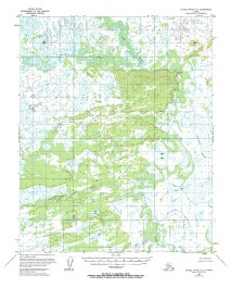
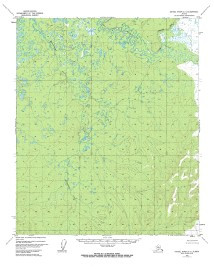
- Added KATEEL RIVER A-1, AK to cart. View cart.
Product Details
- Product Number
- 35530
- Scale
- 1:63,360
- Alternate ID
- TAK1354
- ISBN
- 978-0-607-02287-2
- Version Date
- 01/01/1972
- Regions
- AK
- Countries
- USA
- Media
- Paper
- Format
- Flat
- Digital Reproduction
- Yes
Additional Details
- Description
- KATEEL RIVER A-1, AK
- Print Date
- 1974
- Boundary Type
- Quadrangle
- Two Sided
- No
- Pieces
- 1
- Languages
- English
Related Items