

Product Details
- Product Number
- 35393
- Series
- 66153-A1-TF-250-00
- Scale
- 1:250,000
- Alternate ID
- TAK1217
- ISBN
- 978-0-607-02158-5
- Version Date
- 01/01/1956
- Regions
- AK
- Countries
- USA
- Media
- Paper
- Format
- Flat
- Digital Reproduction
- Yes
Additional Details
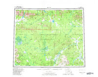
- Description
- HUGHES, AK HISTORICAL MAP GEOPDF 1X3 GRID 250000-SCALE 1956
- Survey Date
- 1956
- Print Date
- 1982
- Height In Inches
- 24.310
- Length In Inches
- 30.540
- Boundary Type
- Quadrangle
- Two Sided
- No
- Pieces
- 1
- Languages
- English
Related Items
