
- Added PILOT PEAK, ID to cart. View cart.
- Added PAPOOSE PEAK, ID to cart. View cart.
- Added THOMPSON PINE ISLAND, FL to cart. View cart.
- Added BLUFFTON, GA to cart. View cart.
- Added HOLLEY, FL to cart. View cart.
- Added CHARLEY RIVER C-1, AK to cart. View cart.
- Added ALTHA EAST, FL HISTORICAL MAP GEOPDF 7.5 to cart. View cart.
- Added KNIFE EDGE, CO to cart. View cart.
- Added FORT WALTON BEACH, FL to cart. View cart.
- Added BLUE RIDGE, GA to cart. View cart.


Product Details
- Product Number
- 276184
- Scale
- 1:24,000
- Version Date
- 01/01/1947
- Regions
- TN, NC, GA
- Countries
- USA
- Media
- Paper
- Format
- Flat
Additional Details
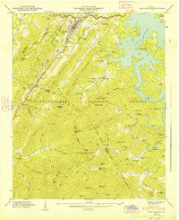
- Description
- BLUE RIDGE, GA-TN-NC HISTORICAL MAP GEOPDF 15X15 GRID 24000-SCALE 1947
- Survey Date
- 1947
- Print Date
- 1947
- Height In Inches
- 27.050
- Length In Inches
- 21.940
- Boundary Type
- Quadrangle
- Pieces
- 1
Related Items
BLUE RIDGE, GA HISTORICAL MAP GEOPDF 7.5X7.5 GRID 24000-SCALE 1947