
- Added CHEROKEE SOUTH, IA HISTORICAL MAP GEOPDF to cart. View cart.
- Added SAINT JOSEPH, IA HISTORICAL MAP GEOPDF 7 to cart. View cart.
- Added KEYSTONE NORTH, IA HISTORICAL MAP GEOPDF to cart. View cart.
- Added MANNING, IA HISTORICAL MAP GEOPDF 7.5X7. to cart. View cart.
- Added STANWOOD, IA HISTORICAL MAP GEOPDF 30X30 to cart. View cart.
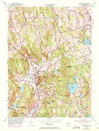
- Added WOODBURY, CT to cart. View cart.


Product Details
- Product Number
- 351841
- Scale
- 1:24,000
- Version Date
- 01/01/1970
- Regions
- CT
- Countries
- USA
- Media
- Paper
- Format
- Flat
Additional Details
- Description
- WOODBURY, CT HISTORICAL MAP GEOPDF 7.5X7.5 GRID 24000-SCALE 1955
- Survey Date
- 1955
- Print Date
- 1972
- Height In Inches
- 27.100
- Length In Inches
- 20.400
- Boundary Type
- Quadrangle
- Pieces
- 1
Related Items

WOODBURY, CT HISTORICAL MAP GEOPDF 7.5X7.5 GRID 24000-SCALE 1955