
- Added HYDROGEOLOGY SNAKE RIVER WY 2008 - 2009 to cart. View cart.
- Added KENTUCY - CORRELATION CHART, KY to cart. View cart.
- Added KENDALL EAST, WI to cart. View cart.
- Added BALANCED ROCK, ID to cart. View cart.
- Added KETCHIKAN A-4 NE, AK to cart. View cart.
- Added BUFFALO GAP NG, SD to cart. View cart.
- Added JUNEAU C-4 NE, AK to cart. View cart.
- Added GEOLOGIC MAP TELLURIDE QUADRANGLE, CO to cart. View cart.
- Added DE LONG MOUNTAINS D-2, AK to cart. View cart.

Product Details
- Product Number
- 35067
- Scale
- 1:63,360
- Alternate ID
- TAK0889
- ISBN
- 978-0-607-01851-6
- Version Date
- 01/01/1955
- Regions
- AK
- Countries
- USA
- Media
- Paper
- Format
- Flat
- Digital Reproduction
- Yes
Additional Details
- Description
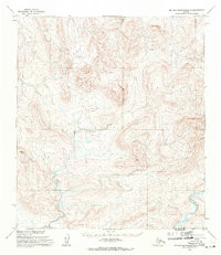
- DE LONG MOUNTAINS B-5, AK HISTORICAL MAP GEOPDF 15X15 GRID 63360-SCALE 1955
- Survey Date
- 1955
- Print Date
- 1971
- Height In Inches
- 20.900
- Length In Inches
- 18.100
- Boundary Type
- Quadrangle
- Two Sided
- No
- Pieces
- 1
- Languages
- English
Related Items

DE LONG MOUNTAINS A-4, AK HISTORICAL MAP GEOPDF 15X15 GRID 63360-SCALE 1955

DE LONG MOUNTAINS D-1, AK HISTORICAL MAP GEOPDF 15X15 GRID 63360-SCALE 1955

DE LONG MOUNTAINS D-2, AK HISTORICAL MAP GEOPDF 15X15 GRID 63360-SCALE 1955