
- Added EUREKA, NV to cart. View cart.
- Added BUCKEYE, CO to cart. View cart.
- Added GAINESVILLE, FL to cart. View cart.
- Added LEBANON JUNCTION, KY to cart. View cart.
- Added WIND GAP, PA to cart. View cart.
- Added FORK RIDGE, TN-KY to cart. View cart.
- Added EDDYVILLE, NV to cart. View cart.
- Added PARKER, SD HISTORICAL MAP GEOPDF 30X30 G to cart. View cart.
- Added WHITE PLAINS, NY to cart. View cart.
- Added ISLE AU HAUT EAST, ME to cart. View cart.
- Added HARVEY, IA HISTORICAL MAP GEOPDF 7.5X7.5 to cart. View cart.
- Added GRANTS PASS, OR to cart. View cart.
- Added MONSON, MA-CT to cart. View cart.


Product Details
- Product Number
- 336139
- Scale
- 1:25,000
- Version Date
- 01/01/1975
- Regions
- CT, MA
- Countries
- USA
- Media
- Paper
- Format
- Flat
Additional Details
- Description
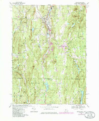
- MONSON, MA-CT HISTORICAL MAP GEOPDF 7.5X7.5 GRID 25000-SCALE 1975
- Survey Date
- 1975
- Print Date
- 1981
- Height In Inches
- 26.800
- Length In Inches
- 22.000
- Boundary Type
- Quadrangle
- Pieces
- 1
Related Items
MONSON, MA-CT HISTORICAL MAP GEOPDF 7.5X7.5 GRID 25000-SCALE 1967