
- Added CLANTON, AL HISTORICAL MAP GEOPDF 30X60 to cart. View cart.
- Added SURVEY PASS C-6, AK to cart. View cart.
- Added BRUSHY BUTTE, SD to cart. View cart.
- Added SPRINGFIELD, NE HISTORICAL MAP GEOPDF 7. to cart. View cart.
- Added AGENCY CREEK, ID to cart. View cart.
- Added FLORENCE, AL HISTORICAL MAP GEOPDF 7.5X7 to cart. View cart.
- Added SARDIS, MS to cart. View cart.
- Added CARLTON, AL to cart. View cart.
- Added COAL HILL, AR to cart. View cart.
- Added BELLWOOD, AL to cart. View cart.
- Added SHEEP CANYON CREEK WEST, WY to cart. View cart.
- Added FISK, AL-TN to cart. View cart.


Product Details
- Product Number
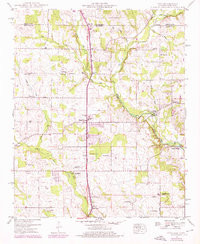
- 311748
- Scale
- 1:24,000
- Version Date
- 01/01/1948
- Regions
- AL, TN
- Countries
- USA
- Media
- Paper
- Format
- Flat
Additional Details
- Description
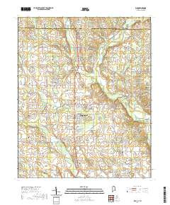
- FISK, AL-TN HISTORICAL MAP GEOPDF 7.5X7.5 GRID 24000-SCALE 1948
- Survey Date
- 1948
- Print Date
- 1971
- Height In Inches
- 26.800
- Length In Inches
- 22.000
- Boundary Type
- Quadrangle
- Pieces
- 1
Related Items
FISK, AL-TN HISTORICAL MAP GEOPDF 7.5X7.5 GRID 24000-SCALE 1948