- Added HALES CORNERS, WI to cart. View cart.
- Added BARBOURSVILLE, VA to cart. View cart.
- Added HEALY B-4 NW, AK to cart. View cart.
- Added RICE LAKE, WI to cart. View cart.
- Added CEDAR MESA NORTH, UT to cart. View cart.
- Added WESTFIELD EAST, WI to cart. View cart.
- Added QUEBRADILLAS, PR to cart. View cart.
- Added BORREGO MOUNTAIN, CA HISTORICAL MAP GEOP to cart. View cart.
- Added GROUND WATER AVAILABILITY IN THE US to cart. View cart.
- Added BECKWITH HILLS, TX to cart. View cart.
- Added WELLFLEET, NE to cart. View cart.
- Added TWIN BUTTES, MT to cart. View cart.
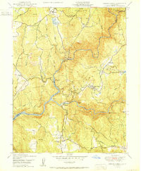
- Added FRENCH CORRAL, CA to cart. View cart.

Product Details
- Product Number
- 846471
- Scale
- 1:24,000
- Version Date
- 01/01/1950
- Regions
- CA
- Countries
- USA
- Media
- Paper
- Format
- Flat
- Digital Reproduction
- Yes
Additional Details
- Description
- FRENCH CORRAL, CA HISTORICAL MAP GEOPDF 7.5X7.5 GRID 24000-SCALE 1950
- Survey Date
- 1950
- Print Date
- 1950
- Boundary Type
- Quadrangle
- Pieces
- 1
Related Items