- Added DELAVAN, WI to cart. View cart.
- Added STATISTICAL METHODS IN WATER RESOURCES to cart. View cart.
- Added FLENER, KY to cart. View cart.
- Added GEORGETOWN, TX to cart. View cart.
- Added KENIEBA, MALI to cart. View cart.
- Added TOBIAS, NE to cart. View cart.
- Added SHERWOOD POINT, CT-NY to cart. View cart.
- Added LAKE LOWELL, ID to cart. View cart.
- Added ROCK HOUSE CANYON, NM to cart. View cart.
- Added TEMPLE PEAK, WY to cart. View cart.
- Added CONTROLLED MOSAIC SINUS SABAEUS SW MARS to cart. View cart.
- Added RICHFIELD, ZINC IN STR SEDIMEN, UT to cart. View cart.
- Added BLUE LAKE, CA to cart. View cart.
- Added KISHANGARH, INDIA to cart. View cart.
- Added WINCHENDON, MA-NH HISTORICAL MAP GEOPDF to cart. View cart.
- Added JUMP RIVER FIRE TOWER, WI to cart. View cart.
- Added MEDICINE BOW RIVER SATELLITE IMAGE, WY to cart. View cart.
Product Details
- Product Number
- 28975
- Scale
- 1:500,000
- Alternate ID
- GLI0024T
- ISBN
- 978-0-607-79643-8
- Version Date
- 01/01/1973
- Regions
- MT
- Countries
- USA
- Media
- Paper
- Format
- Flat
Additional Details
- Description
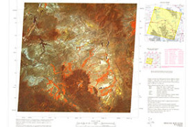
- SATELLITE IMAGE, NASA LANDSAT-1
- Survey Date
- 1973
- Print Date
- 1979
- Height In Inches
- 21.000
- Length In Inches
- 25.000
- Boundary Type
- Quadrangle
- Two Sided
- No
- Pieces
- 1
- Languages
- English
Related Items