
Added POWDER RIVER BASIN,N/2,CRETACE, MT to cart. View cart.


Product Details
- Product Number
- 31768
- Series
- MF-2140-D
- Scale
- 1:500,000
- Alternate ID
- GMF2140DD
- ISBN
- 978-0-607-82083-6
- Authors
- CRYSDALE, B. L.
- Version Date
- 01/01/1991
- Regions
- WY, MT
- Countries
- USA
- Media
- Paper
- Format
- Folded
Additional Details
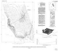
- Description
- Map showing contours on top of the upper Cretaceous Mowry Shale, Powder River basin, Wyoming and Montana
- Survey Date
- 1991
- Print Date
- 1991
- Boundary Type
- Quadrangle
- Two Sided
- No
- Pieces
- 1
- Languages
- English
Related Items
Map showing structure contours on the top of the upper Jurassic Morrison Formation, Powder River basin, Wyoming and Montana
Map showing contours on the top of the Pennsylvanian and Permian Minnelusa Formation and equivalents, Powder River basin, Wyoming and Montana
Geologic map showing thickness of the upper Cretaceous Pierre Shale in the north half of the Powder River basin, southeastern Montana and northeastern Wyoming