

Product Details
- Product Number
- 28400
- Series
- I-2210
- Scale
- 1:100,000
- Alternate ID
- GI2210D
- ISBN
- 978-0-607-79388-8
- Authors
- GEOLOGICAL SURVEY (U.S.)
- Version Date
- 01/01/1995
- Regions
- UT, WY
- Countries
- USA
- Media
- Paper
- Format
- Flat
- Digital Reproduction
- Yes
Additional Details
- Description
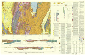
- Geologic map of the Logan 30' x 60' Quadrangle, Cache and Rich counties, Utah, and Lincoln and Uinta counties, Wyoming
- Survey Date
- 1995
- Print Date
- 1995
- Height In Inches
- 37.000
- Length In Inches
- 57.190
- Boundary Type
- Quadrangle
- Two Sided
- No
- Pieces
- 1
- Languages
- English
Related Items

Geologic map of the Kemmerer 30' x 60' Quadrangle, Lincoln, Uinta, and Sweetwater counties, Wyoming
Geologic map of the Evanston 30' x 60' Quadrangle, Uinta and Sweetwater counties, Wyoming
Geologic map of the Price 30' x 60' Quadrangle, Carbon, Duchesne, Uinta, Utah and Wasatch counties, Utah