- Added RACINE SOUTH, WI to cart. View cart.
- Added BUFFALO SPRINGS LAKE, TX to cart. View cart.
- Added FELKNER HILL, CA to cart. View cart.
- Added LONE BUTTE, ID to cart. View cart.
- Added PETERSON, UT to cart. View cart.
- Added ATLIN B-8 SE, AK to cart. View cart.
- Added RAPPAHANNOCK ACADEMY, VA to cart. View cart.
- Added HALL MOUNTAIN, ID to cart. View cart.
- Added MOUNT BONAPARTE, WA HISTORICAL MAP GEOPD to cart. View cart.
- Added LAKE LUCERNE, WI to cart. View cart.
- Added CADIZ VALLEY NE, CA HISTORICAL MAP GEOPD to cart. View cart.
- Added WEST OF JOHNSON BAYOU, LA-TX HISTORICAL to cart. View cart.
- Added TRIGO PEAKS, AZ to cart. View cart.
- Added HUDSON, WI-MN HISTORICAL MAP GEOPDF 7.5X to cart. View cart.
- Added ELKHORN CREEK, ID to cart. View cart.
- Added RIB LAKE, WI HISTORICAL MAP GEOPDF 15X15 to cart. View cart.
- Added FERNAN LAKE, ID to cart. View cart.
- Added DESERT, CA-NV to cart. View cart.
- Added DIXON ENTRANCE D-3 NW, AK to cart. View cart.
- Added CACTUS EAST, TX to cart. View cart.
- Added ATLIN A-8 SE, AK to cart. View cart.
- Added POTENTIOMETRIC SURFACE OF THE UPPER to cart. View cart.
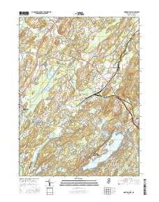
- Added NEWTON EAST, NJ to cart. View cart.


Product Details
- Product Number
- 278631
- Scale
- 1:24,000
- Version Date
- 01/01/1954
- Regions
- NJ
- Countries
- USA
- Media
- Paper
- Format
- Flat
Additional Details
- Description
- NEWTON EAST, NJ HISTORICAL MAP GEOPDF 7.5X7.5 GRID 24000-SCALE 1954
- Survey Date
- 1954
- Print Date
- 1955
- Height In Inches
- 27.000
- Length In Inches
- 22.000
- Boundary Type
- Quadrangle
- Pieces
- 1
Related Items