
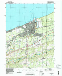
Added CONNEAUT, OH-PA to cart. View cart.


Product Details
- Product Number
- 266865
- Scale
- 1:24,000
- Version Date
- 01/01/1960
- Regions
- OH, PA
- Countries
- USA
- Media
- Paper
- Format
- Flat
Additional Details
- Description
- CONNEAUT, OH-PA HISTORICAL MAP GEOPDF 7.5X7.5 GRID 24000-SCALE 1960
- Survey Date
- 1960
- Print Date
- 1965
- Height In Inches
- 26.800
- Length In Inches
- 22.000
- Boundary Type
- Quadrangle
- Pieces
- 1
Related Items
CONNEAUT, OH-PA HISTORICAL MAP GEOPDF 7.5X7.5 GRID 24000-SCALE 1996
CONNEAUT LAKE, PA HISTORICAL MAP GEOPDF 7.5X7.5 GRID 24000-SCALE 1959