
- Added MONK DRAW, AZ to cart. View cart.
- Added NORTH FORK, ID to cart. View cart.
- Added POVERTY KNOLL, AZ to cart. View cart.
- Added MOUNT JOSH, AZ to cart. View cart.
- Added BASIN, MT to cart. View cart.
- Added APPLEGATE BUTTE, OR to cart. View cart.
- Added ISLAND FALLS, ME to cart. View cart.
- Added GLEN FALLS, NY HISTORICAL MAP GEOPDF 15X to cart. View cart.
- Added POINT OF PINES EAST, AZ to cart. View cart.
- Added LONE BUTTE, AZ to cart. View cart.
- Added ISLAND POND, ME to cart. View cart.
- Added HOLE IN ROCK VALLEY, AZ to cart. View cart.
- Added PEACH SPRINGS CANYON, AZ to cart. View cart.
- Added TOM THUMB, AZ to cart. View cart.
- Added SHELL BLUFF LANDING, GA-SC to cart. View cart.
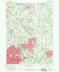
- Added HUDSON, OH to cart. View cart.


Product Details
- Product Number
- 268725
- Scale
- 1:24,000
- Version Date
- 01/01/1979
- Regions
- OH
- Countries
- USA
- Media
- Paper
- Format
- Flat
Additional Details
- Description
- HUDSON, OH HISTORICAL MAP GEOPDF 7.5X7.5 GRID 24000-SCALE 1963
- Survey Date
- 1953
- Print Date
- 1980
- Height In Inches
- 27.000
- Length In Inches
- 22.000
- Boundary Type
- Quadrangle
- Pieces
- 1
Related Items
HUDSON, OH HISTORICAL MAP GEOPDF 7.5X7.5 GRID 24000-SCALE 1963