
- Added ANTELOPE HILL, NM HISTORICAL MAP GEOPDF to cart. View cart.
- Added ROSITA LAKE, TX to cart. View cart.
- Added UNION, MO to cart. View cart.
- Added MINERAL, VA to cart. View cart.
- Added ROCKPORT, MA to cart. View cart.
- Added GULLY, MN to cart. View cart.
- Added SPHINX MOUNTAIN, MT to cart. View cart.
- Added DEER ISLE, ME to cart. View cart.
- Added LOMA DE LAS CANAS, NM HISTORICAL MAP GEO to cart. View cart.
- Added ARLINGTON NE, CO to cart. View cart.
- Added WINSLOW NE, AZ to cart. View cart.
- Added KENSINGTON, MD to cart. View cart.
- Added LAKE BENTON NW, MN-SD to cart. View cart.
- Added TAYLOR MONUMENT, CA to cart. View cart.
- Added BACK, TX HISTORICAL MAP GEOPDF 7.5X7.5 G to cart. View cart.
- Added BEREA, KY to cart. View cart.
- Added SUNLAND, CA to cart. View cart.
- Added LOMA DE LAS CANAS, NM to cart. View cart.
- Added ADRIAN, SC to cart. View cart.
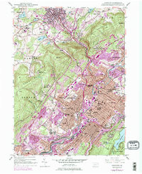
- Added SCRANTON, PA to cart. View cart.


Product Details
- Product Number
- 359938
- Scale
- 1:24,000
- Version Date
- 01/01/1947
- Regions
- PA
- Countries
- USA
- Media
- Paper
- Format
- Flat
Additional Details
- Description
- SCRANTON, PA HISTORICAL MAP GEOPDF 7.5X7.5 GRID 24000-SCALE 1947
- Survey Date
- 1947
- Print Date
- 1957
- Height In Inches
- 27.000
- Boundary Type
- Quadrangle
- Pieces
- 1
Related Items
SCRANTON, PA HISTORICAL MAP GEOPDF 7.5X7.5 GRID 24000-SCALE 1947