
- Added LAUREL, IA HISTORICAL MAP GEOPDF 7.5X7.5 to cart. View cart.
- Added BITTERROOT NF, MT & ID - ATLAS to cart. View cart.
- Added LAUREL, IA to cart. View cart.
- Added LAWTON, IA to cart. View cart.
- Added LANYON, IA to cart. View cart.
- Added LAKE CITY, IA to cart. View cart.
- Added OSKALOOSA, KS to cart. View cart.
- Added MARSHALLTOWN, IA HISTORICAL MAP GEOPDF 1 to cart. View cart.
- Added LAFAYETTE, IA to cart. View cart.
- Added OSKALOOSA, IA to cart. View cart.
- Added SHEFFIELD, IA HISTORICAL MAP GEOPDF 7.5X to cart. View cart.
- Added SYLVANIA NORTH, GA HISTORICAL MAP GEOPDF to cart. View cart.
- Added BEAR VALLEY MOUNTAIN, ID to cart. View cart.
- Added OMAHA NORTH, NE-IA to cart. View cart.
- Added OAKLAND, IA to cart. View cart.
- Added SEYMOUR WEST, IA to cart. View cart.
- Added LUTHER, IA to cart. View cart.


Product Details
- Product Number
- 265140
- Scale
- 1:24,000
- Version Date
- 01/01/1965
- Regions
- IA
- Countries
- USA
- Media
- Paper
- Format
- Flat
Additional Details
- Description
- LUTHER, IA HISTORICAL MAP GEOPDF 7.5X7.5 GRID 24000-SCALE 1965
- Survey Date
- 1965
- Print Date
- 1967
- Height In Inches
- 26.900
- Length In Inches
- 22.100
- Boundary Type
- Quadrangle
- Pieces
- 1
Related Items

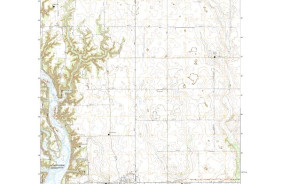
LUTHER, IA HISTORICAL MAP GEOPDF 7.5X7.5 GRID 24000-SCALE 1965