
- Added TIMPAS NW, CO to cart. View cart.
- Added CAMERON, WV-PA-OH HISTORICAL MAP GEOPDF to cart. View cart.
- Added CHILLICOTHE WEST, OH to cart. View cart.
- Added WEST OF LUKEVILLE, AZ HISTORICAL MAP GEO to cart. View cart.
- Added MCNARY, AZ to cart. View cart.
- Added SAINT HELENA SOUND, SC to cart. View cart.
- Added BUCKHORN PEAK, CA HISTORICAL MAP GEOPDF to cart. View cart.
- Added TRINCHERA, CO to cart. View cart.
- Added NORTONVILLE, KY to cart. View cart.
- Added RIVERVIEW, WY to cart. View cart.
- Added WEST POKER MOUNTAIN, AZ to cart. View cart.
- Added LOVELAND PASS, CO to cart. View cart.
- Added CICERO, NY to cart. View cart.
- Added FORT SMITH, AR-OK HISTORICAL MAP GEOPDF to cart. View cart.
- Added FORESTHILL, CA to cart. View cart.
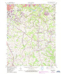
- Added INDEPENDENCE, KY to cart. View cart.


Product Details
- Product Number
- 261984
- Scale
- 1:24,000
- Version Date
- 01/01/1981
- Regions
- KY
- Countries
- USA
- Media
- Paper
- Format
- Flat
Additional Details
- Description
- INDEPENDENCE, KY HISTORICAL MAP GEOPDF 7.5X7.5 GRID 24000-SCALE 1981
- Survey Date
- 1981
- Print Date
- 1982
- Height In Inches
- 27.400
- Length In Inches
- 22.500
- Boundary Type
- Quadrangle
- Pieces
- 1
Related Items

INDEPENDENCE, KY HISTORICAL MAP GEOPDF 7.5X7.5 GRID 24000-SCALE 1981
