
- Added FALL CREEK, WI to cart. View cart.
- Added CAVE MESA SE, TX to cart. View cart.
- Added LELAND, NC to cart. View cart.
- Added MEYERS CANYON NE, TX to cart. View cart.
- Added CAVE MESA, TX to cart. View cart.
- Added NORMAN, OK to cart. View cart.
- Added GREENWOOD, TX to cart. View cart.
- Added PLEASANT HILL, NM-TX to cart. View cart.
- Added GARY, TX to cart. View cart.
- Added LAMBROOK, AR to cart. View cart.
- Added BIG SPRING NORTH, TX HISTORICAL MAP GEOP to cart. View cart.
- Added FALL RIVER, WI to cart. View cart.
- Added MORGANTOWN NORTH, WV-PA to cart. View cart.
- Added CAPE VINCENT SOUTH OE W, NY to cart. View cart.
- Added GOLDSTONE MOUNTAIN, ID-MT to cart. View cart.
- Added IRON LAKE, WI to cart. View cart.


Product Details
- Product Number
- 348386
- Scale
- 1:48,000
- Version Date
- 01/01/1905
- Regions
- AL
- Countries
- USA
- Media
- Paper
- Format
- Flat
Additional Details
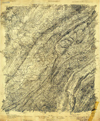
- Description
- BESSEMER IRON DISTRICT, AL HISTORICAL MAP GEOPDF 15X15 GRID 48000-SCALE 1905
- Survey Date
- 1905
- Height In Inches
- 26.600
- Length In Inches
- 21.900
- Boundary Type
- Quadrangle
- Pieces
- 1
Related Items
BESSEMER IRON DISTRICT, AL HISTORICAL MAP GEOPDF 15X15 GRID 48000-SCALE 1905
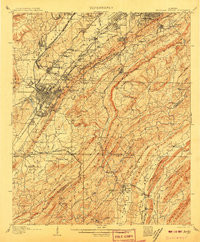
BESSEMER IRON DISTRICT, AL HISTORICAL MAP GEOPDF 15X15 GRID 62500-SCALE 1907