- Added HEMLOCK, MI to cart. View cart.
- Added DRIGGS LAKE SE, MI to cart. View cart.
- Added STREAMFLOW IN UPPER COLORADO, US to cart. View cart.
- Added FORESTVILLE, MI HISTORICAL MAP GEOPDF 7. to cart. View cart.
- Added ROMEO, MI to cart. View cart.
- Added EAGLE BEND, MN to cart. View cart.
- Added POINT MILLS, MI HISTORICAL MAP GEOPDF 7. to cart. View cart.
- Added SOIL CONSERVATION AND THE, WI to cart. View cart.
- Added SOUTHEAST ALBION, MI to cart. View cart.
- Added AMIDON SE, ND HISTORICAL MAP GEOPDF 7.5X to cart. View cart.
- Added VICKSBURG, MI to cart. View cart.
- Added GOODRICH, MI to cart. View cart.
- Added QLTY OF SURF WTR OF US, 1962, US to cart. View cart.
- Added COTE DAME MARIE, MI HISTORICAL MAP GEOPD to cart. View cart.
- Added IRONWOOD, MI-WI to cart. View cart.
Product Details
- Product Number
- 259907
- Scale
- 1:24,000
- Version Date
- 01/01/1955
- Regions
- MI, WI
- Countries
- USA
- Media
- Paper
- Format
- Flat
Additional Details
- Description
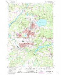
- IRONWOOD, MI-WI HISTORICAL MAP GEOPDF 7.5X7.5 GRID 24000-SCALE 1955
- Survey Date
- 1955
- Print Date
- 1957
- Height In Inches
- 27.200
- Length In Inches
- 20.400
- Boundary Type
- Quadrangle
- Pieces
- 1
Related Items