
- Added BRUNDAGE MOUNTAIN, ID to cart. View cart.
- Added MEXICO, NY to cart. View cart.
- Added BIG FILL RESERVOIR, ID to cart. View cart.
- Added STROUDS, GA HISTORICAL MAP GEOPDF 7.5X7. to cart. View cart.
- Added LEHIGH, IA HISTORICAL MAP GEOPDF 7.5X7.5 to cart. View cart.
- Added HENRY, ID to cart. View cart.
- Added SMARR, GA HISTORICAL MAP GEOPDF 7.5X7.5 to cart. View cart.
- Added BLACK BUTTE WEST, ID to cart. View cart.
- Added SHERIDAN, MO-IA to cart. View cart.
- Added CHILLY BUTTES, ID to cart. View cart.
- Added BOUNDARY PEAK, ID to cart. View cart.
- Added HAMPTON NORTH, IA to cart. View cart.
- Added TABOR SW, IA to cart. View cart.
- Added WEST LIBERTY SW, IA to cart. View cart.
- Added GRANGER BUTTE, ID to cart. View cart.
- Added LONE ROCK, IA to cart. View cart.
- Added BEAR VALLEY MOUNTAIN, ID to cart. View cart.
- Added AMBER LAKES, ID to cart. View cart.
- Added RICE PEAK, ID to cart. View cart.
- Added ROSSVILLE, IA HISTORICAL MAP GEOPDF 7.5X to cart. View cart.
- Added ROCK RAPIDS, IA to cart. View cart.
- Added OSKALOOSA, KS to cart. View cart.


Product Details
- Product Number
- 258207
- Scale
- 1:24,000
- Version Date
- 01/01/1951
- Regions
- KS
- Countries
- USA
- Media
- Paper
- Format
- Flat
Additional Details
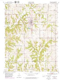
- Description
- OSKALOOSA, KS HISTORICAL MAP GEOPDF 7.5X7.5 GRID 24000-SCALE 1951
- Survey Date
- 1951
- Print Date
- 1952
- Height In Inches
- 27.000
- Length In Inches
- 21.000
- Boundary Type
- Quadrangle
- Pieces
- 1
Related Items
OSKALOOSA, KS HISTORICAL MAP GEOPDF 7.5X7.5 GRID 24000-SCALE 1951