
- Added PESTICIDES IN PUBLIC SUPPLY WE, WA to cart. View cart.
- Added GEOLOGIC MAP OF ANTELOPE KNOLL QUAD to cart. View cart.
- Added GEOLOGY, WATER RESOURCES, SOLANO CTY, CA to cart. View cart.
- Added ATLAS RELATIONS TREES SHRUBS N AMERICA to cart. View cart.
- Added ASSESSING WATER QUALITY IN CAMBRIDGE, MA to cart. View cart.
- Added CHESAPEAKE BAY WATERSHED: 64,000 SQ, VA to cart. View cart.

Product Details
- Product Number
- 17692
- Scale
- NO SCALE
- Alternate ID
- TUS5676
- ISBN
- 978-0-607-96899-6
- Authors
- USGS
- Version Date
- 01/01/1997
- Regions
- DE, MD, DC, NJ, WV, VA, PA, NY
- Countries
- USA
- Media
- Paper
- Format
- Flat
- Digital Reproduction
- Yes
Additional Details
- Description
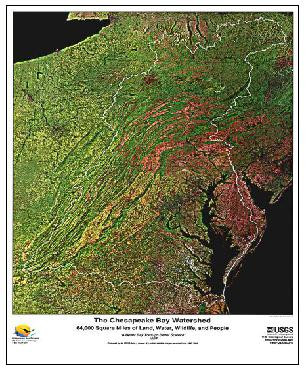
- Use this beautiful satellite image poster to examine the entire Chesapeake Bay watershed and surrounding area. It is designed with information to help improve the understanding of the entire Bay ecosystem and enhance the ability to predict and measure the effects of restoration efforts. Map measures 28"x41".
- Survey Date
- 1997
- Print Date
- 2001
- Height In Inches
- 40.000
- Length In Inches
- 28.000
- Boundary Type
- Quadrangle
- Two Sided
- No
- Pieces
- 1
- Languages
- English
Related Items

The U.S. Geological Survey and the Chesapeake Bay; the role of science in environmental restoration

Changes in streamflow and water quality in selected nontidal sites in the Chesapeake Bay Basin, 1985-2003
