
Added SOUTHERN TOQUIMA RANGE, NV SHT 1 OF 5 to cart. View cart.
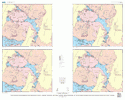
SOUTHERN TOQUIMA RANGE, NV SHT 3 OF 5
$9.00
Available

Product Details
- Product Number
- 115056
- Series
- MF-2327-C
- Scale
- 1:48,000
- Alternate ID
- MF-2327C
- Authors
- DANIEL R. SHAWE
- Version Date
- 01/01/2003
- Regions
- NV
- Countries
- USA
- Media
- Paper
- Format
- Flat
Additional Details
- Description
- Maps Showing the Distribution and Abundance of Iron, Titanium, Vanadium, and Cobalt in Rock Samples from Part of the Southern Toquima Range and Adjacent Areas, Nye County, Nevada SHEET 3 OF 5
- Height In Inches
- 52.000
- Length In Inches
- 66.000
Related Items
Maps Showing the Locations of Rock Samples from Part of the Southern Toquima Range and Adjacent Areas, Nye County, Nevada SHEET 5 OF 5
Maps Showing the Distribution and Abundance of Beryllium, Boron, Fluorine, and Sulfur in Rock Samples from Part of the Southern Toquima Range and Adjacent Areas, Nye County, Nevada SHEET 4 OF 5
Maps Showing the Distribution and Abundance of Gold, Silver, Mercury, Arsenic, and Antimony in Rock Samples from Part of the Southern Toquima Range and Adjacent Areas, Nye County, Nevada SHEET 1 OF 5