
- Added BLACK RIVER FALLS, WI to cart. View cart.
- Added ADAMS, KY HISTORICAL MAP GEOPDF 7.5X7.5 to cart. View cart.
- Added DIAMOND BUTTE, AZ to cart. View cart.
- Added CHIPS CREEK, BUCKS LAKE GEOCHE, CA to cart. View cart.
- Added MERRIMAN SW, NE to cart. View cart.
- Added SAL'SK, RUSSIA to cart. View cart.
- Added STETSON, ME HISTORICAL MAP GEOPDF 15X15 to cart. View cart.
- Added MALTA, ID to cart. View cart.
- Added GULKANA B-3, AK to cart. View cart.
- Added DAVIS, CA to cart. View cart.
- Added GEOLOGIC MAP OF DILLON QUAD, CO to cart. View cart.
- Added GLENDALE, TN to cart. View cart.
- Added CONTROLLED MOSAIC IAPYGIA SW QUAD MARS to cart. View cart.
- Added WINSTON SALEM L-108, US to cart. View cart.

Product Details
- Product Number
- 75667
- Scale
- 1:250,000
- Alternate ID
- TNC1272
- ISBN
- 978-0-607-33612-2
- Version Date
- 01/01/1962
- Regions
- NC, TN, VA
- Countries
- USA
- Media
- Paper
- Format
- Flat
- Digital Reproduction
- Yes
Additional Details
- Description
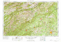
- WINSTON-SALEM, NC-VA-TN HISTORICAL MAP GEOPDF 1X2 GRID 250000-SCALE 1953
- Survey Date
- 1953
- Print Date
- 1974
- Height In Inches
- 21.900
- Length In Inches
- 32.000
- Boundary Type
- Quadrangle
- Two Sided
- No
- Pieces
- 1
- Languages
- English
Related Items
