
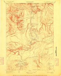

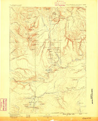
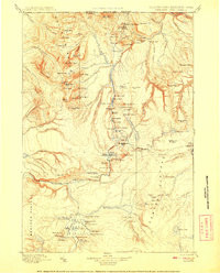
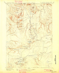
Product Details
- Product Number
- 930063
- Scale
- 1:125,000
- Version Date
- 01/01/1911
- Media
- Paper
- Format
- Flat
- Digital Reproduction
- Yes
Additional Details
- Description
- GALLATIN, WY-MT HISTORICAL MAP GEOPDF 30X30 GRID 125000-SCALE 1911
- Survey Date
- 1911
- Print Date
- 1911
- Boundary Type
- Quadrangle
- Pieces
- 1
Related Items
GALLATIN, WY-MT HISTORICAL MAP GEOPDF 30X30 GRID 125000-SCALE 1885
GALLATIN, WY-MT HISTORICAL MAP GEOPDF 30X30 GRID 125000-SCALE 1908
GALLATIN, WY-MT HISTORICAL MAP GEOPDF 30X30 GRID 125000-SCALE 1901