

Product Details
- Product Number
- 927612
- Scale
- 1:62,500
- Version Date
- 01/01/1901
- Regions
- WI
- Countries
- USA
- Media
- Paper
- Format
- Flat
- Digital Reproduction
- Yes
Additional Details
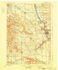
- Description
- WISCONSIN DILLS, WI HISTORICAL MAP GEOPDF 15X15 GRID 62500-SCALE 1901
- Survey Date
- 1901
- Print Date
- 1930
- Boundary Type
- Quadrangle
- Pieces
- 1
Related Items
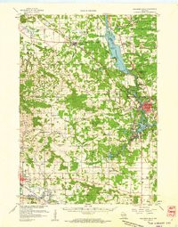
WISCONSIN DILLS, WI HISTORICAL MAP GEOPDF 15X15 GRID 62500-SCALE 1957
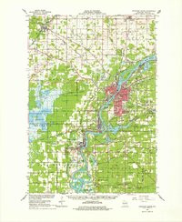
WISCONSIN RAPIDS, WI HISTORICAL MAP GEOPDF 15X15 GRID 62500-SCALE 1967
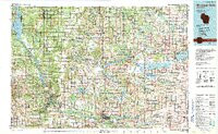
WISCONSIN DELLS, WI HISTORICAL MAP GEOPDF 30X60 GRID 100000-SCALE 1990