
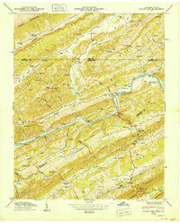

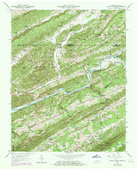
Product Details
- Product Number
- 910071
- Scale
- 1:24,000
- Version Date
- 01/01/1950
- Media
- Paper
- Format
- Flat
- Digital Reproduction
- Yes
Additional Details
- Description
- KYLES FORD, TN-VA HISTORICAL MAP GEOPDF 7.5X7.5 GRID 24000-SCALE 1950
- Survey Date
- 1950
- Print Date
- 1950
- Boundary Type
- Quadrangle
- Pieces
- 1
Related Items
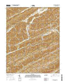

KYLES FORD, TN-VA HISTORICAL MAP GEOPDF 7.5X7.5 GRID 24000-SCALE 1969