

Product Details
- Product Number
- 90363
- Scale
- 1:250,000
- Alternate ID
- TOR2312
- ISBN
- 978-0-607-45943-2
- Version Date
- 01/01/1973
- Regions
- WA, OR
- Countries
- USA
- Media
- Paper
- Format
- Flat
- Digital Reproduction
- Yes
Additional Details
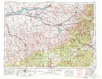
- Description
- PENDLETON, OR-WA HISTORICAL MAP GEOPDF 1X2 GRID 250000-SCALE 1953
- Survey Date
- 1953
- Print Date
- 1980
- Height In Inches
- 22.000
- Length In Inches
- 28.400
- Boundary Type
- Quadrangle
- Two Sided
- No
- Pieces
- 1
- Languages
- English
Related Items
