
Product Details
- Product Number
- 63265
- Scale
- 1:24,000
- Alternate ID
- TMD0238
- ISBN
- 978-0-607-23700-9
- Version Date
- 01/01/1973
- Regions
- MD
- Countries
- USA
- Media
- Paper
- Format
- Flat
- Digital Reproduction
- Yes
Additional Details
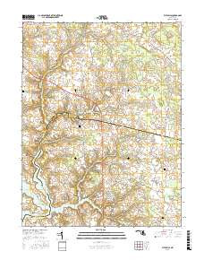
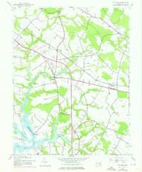
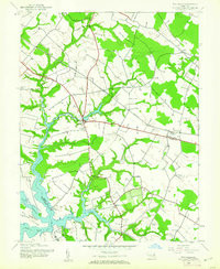
- Description
- WYE MILLS, MD HISTORICAL MAP GEOPDF 7.5X7.5 GRID 24000-SCALE 1942
- Survey Date
- 1942
- Print Date
- 1976
- Height In Inches
- 27.000
- Length In Inches
- 21.750
- Boundary Type
- Quadrangle
- Two Sided
- No
- Pieces
- 1
- Languages
- English
Related Items

WYE MILLS, MD HISTORICAL MAP GEOPDF 7.5X7.5 GRID 24000-SCALE 1942