Product

VISIT THE USGS NATIONAL WATER DASHBOARD

$0.00
Available

Product Details

Product Number
534149
Series
GIP-213
Scale
NO SCALE
Alternate ID
GIP-213
Authors
BRIAN E MCCALLUM
Version Date
01/01/2022
Countries
USA
Media
Paper
Format
Flat

Additional Details

Description

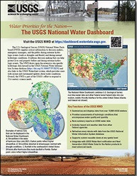
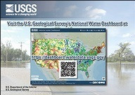
Visit the U.S. Geological Survey’s National Water Dashboard

This product is not available for order, it can only be downloaded from here (click on image) or within the Publications Warehouse at https://pubs.er.usgs.gov/publication/gip213

First posted March 2, 2022

For additional information, contact: Associate Director, Water Resources Mission Area

https://www.usgs.gov/mission-areas/water-resources

U.S. Geological Survey 12201 Sunrise Valley Drive Reston, VA 20192

Contact Pubs Warehouse at https://pubs.er.usgs.gov/contact

Abstract

The U.S. Geological Survey National Water Dashboard supplies critical information to decision makers, emergency managers, and the public during extreme hydrologic events (such as droughts and floods) and during normal hydrologic conditions. It informs decision making that can help protect lives and property before and during extreme hydrologic events. The National Water Dashboard draws upon the extensive site-specific hydrologic data housed in the U.S. Geological Survey National Water Information System database (https://doi.org/10.5066/F7P55KJN) and also links to the U.S. Geological Survey WaterAlert system, which provides users with instant and customized updates about water conditions. Overall, the National Water Dashboard is part of the U.S. Geological Survey's effort to respond to 21st century science needs.

Survey Date
2022
Print Date
2022
Height In Inches
8.500
Length In Inches
11.000
Two Sided
Yes
Pieces
1
Languages
English
Related Items
THE USGS NATIONAL WATER DASHBOARD
<p> Water Priorities for the Nation—The USGS National Water Dashboard <p> </p> <font color=red><i> <p> This product is not available for order, it can only be downloaded from here (click on image) or within the Publications Warehouse at https://pubs.er.usgs.gov/publication/fs20223003 </p> </i> </font> <p> <p> First posted March 2, 2022 <p> For additional information, contact: Associate Director, Water Resources Mission Area https://www.usgs.gov/mission-areas/water-resources U.S. Geological Survey 12201 Sunrise Valley Drive Reston, VA 20192 <p> <p> Abstract <p> <p> The U.S. Geological Survey National Water Dashboard supplies critical information to decision makers, emergency managers, and the public during extreme hydrologic events (such as droughts and floods) and during normal hydrologic conditions. It informs decision making that can help protect lives and property before and during extreme hydrologic events. The National Water Dashboard draws upon the extensive site-specific hydrologic data housed in the U.S. Geological Survey National Water Information System database (https://doi.org/10.5066/F7P55KJN) and also links to the U.S. Geologic Survey WaterAlert system, which provides users with instant and customized updates about water conditions. Overall, the National Water Dashboard is part of the U.S. Geological Survey's effort to respond to 21st century science needs. <p>
Water Priorities for the Nation
<p> Prioridades de la nación referentes al agua— Panel Nacional del Agua del USGS <p> </p> <font color=red><i> <p> This product is not available for order, it can only be downloaded from here (click on image) or within the Publications Warehouse at https://pubs.er.usgs.gov/publication/fs20223003 </p> </i> </font> <p> <p> First posted March 2, 2022 <p> For additional information, contact: Associate Director, Water Resources Mission Area https://www.usgs.gov/mission-areas/water-resources U.S. Geological Survey 12201 Sunrise Valley Drive Reston, VA 20192 <p> <p> Abstract <p> <p> The U.S. Geological Survey National Water Dashboard supplies critical information to decision makers, emergency managers, and the public during extreme hydrologic events (such as droughts and floods) and during normal hydrologic conditions. It informs decision making that can help protect lives and property before and during extreme hydrologic events. The National Water Dashboard draws upon the extensive site-specific hydrologic data housed in the U.S. Geological Survey National Water Information System database (https://doi.org/10.5066/F7P55KJN) and also links to the U.S. Geologic Survey WaterAlert system, which provides users with instant and customized updates about water conditions. Overall, the National Water Dashboard is part of the U.S. Geological Survey's effort to respond to 21st century science needs. <p>
COLORADO WATER SCIENCE CENTER POSTCARD
U.S. Geological Survey Colorado Water Science Center Postcard <p> <p> General Information Product 224 <p> <p> By: Jeannette H. Oden <p> <p> https://doi.org/10.3133/gip224 <p> <p> First posted June 21, 2023 <p> <p> For additional information, contact: <p> <p> Director, Colorado Water Science Center <p> https://www.usgs.gov/centers/colorado-water-science-center/ <p> U.S. Geological Survey <p> Box 25046, Mail Stop 415 <p> Denver, CO 80225 <p> <p> Abstract <p> <p> The U.S. Geological Survey Colorado Water Science Center provides timely, high-quality science information on Colorado’s water resources to help planners, managers, and others to make the decisions necessary for the use of these limited and shared resources throughout the State. <p>