


Product Details
- Product Number
- 39043
- Scale
- 1:100,000
- Alternate ID
- TAL1152
- ISBN
- 978-0-607-05259-6
- Version Date
- 01/01/1984
- Regions
- TN, AL
- Countries
- USA
- Media
- Paper
- Format
- Flat
- Digital Reproduction
- Yes
Additional Details
- Description
- TOPO METRIC
- Survey Date
- 1984
- Print Date
- 1988
- Height In Inches
- 24.070
- Length In Inches
- 42.570
- Boundary Type
- Quadrangle
- Two Sided
- No
- Pieces
- 1
- Languages
- English
Related Items

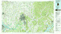
HUNTSVILLE, AL-TN HISTORICAL MAP GEOPDF 30X60 GRID 100000-SCALE 1984
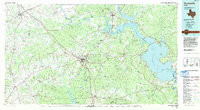
HUNTSVILLE, TX HISTORICAL MAP GEOPDF 30X60 GRID 100000-SCALE 1985