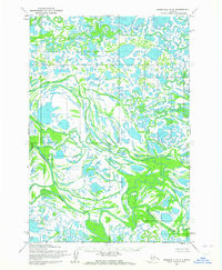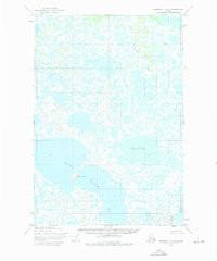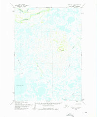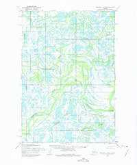

Product Details
- Product Number
- 35813
- Scale
- 1:63,360
- Alternate ID
- TAK1639
- ISBN
- 978-0-607-02565-1
- Version Date
- 01/01/1952
- Regions
- AK
- Countries
- USA
- Media
- Paper
- Format
- Flat
- Digital Reproduction
- Yes
Additional Details
- Description
- MARSHALL D-6, AK HISTORICAL MAP GEOPDF 15X15 GRID 63360-SCALE 1952
- Survey Date
- 1952
- Print Date
- 1975
- Height In Inches
- 21.700
- Length In Inches
- 18.000
- Boundary Type
- Quadrangle
- Two Sided
- No
- Pieces
- 1
- Languages
- English
Related Items