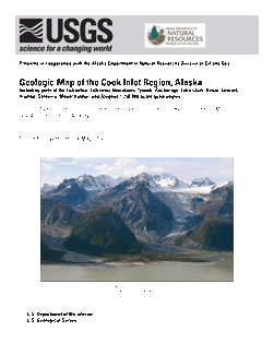
GEOLOGIC MAP COOK INLET REGION, ALASKA

Product Details
- Product Number
- 356688
- Series
- SIM-3153
- Scale
- 1:250,000
- Alternate ID
- SIM3153
- ISBN
- 978-1-4113-3425-0
- Authors
- PETER J HAEUSSLER
- Version Date
- 01/01/2012
- Regions
- AK
- Countries
- USA
- Media
- Paper
- Format
- Folded
Additional Details
- Description
-
Summary
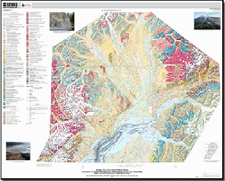
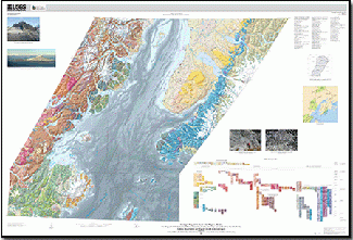
In 1976, L.B. Magoon, W.L. Adkinson, and R.M. Egbert published a major geologic map of the Cook Inlet region, which has served well as a compilation of existing information and a guide for future research and mapping. The map in this report updates Magoon and others (1976) and incorporates new and additional mapping and interpretation. This map is also a revision of areas of overlap with the geologic map completed for central Alaska (Wilson and others, 1998). Text from that compilation remains appropriate and is summarized here; many compromises have been made in strongly held beliefs to allow construction of this compilation. Yet our willingness to make interpretations and compromises does not allow resolution of all mapping conflicts. Nonetheless, we hope that geologists who have mapped in this region will recognize that, in incorporating their work, our regional correlations may have required some generalization or lumping of map units. Many sources were used to produce this geologic map and, in most cases, data from available maps were combined, without generalization, and new data were added where available.
A preliminary version of this map was published as U.S. Geological Survey Open-File Report 2009–1108. The main differences between the versions concern revised mapping of surfical deposits in the northern and eastern parts of the map area. Minor error corrections have been made also.
- Print Date
- 2012
- Height In Inches
- 48.000
- Length In Inches
- 68.000
- Two Sided
- No
- Pieces
- 3
- Languages
- English