

Product Details
- Product Number
- 315285
- Series
- FS-2011-3018
- Scale
- NO SCALE
- Alternate ID
- FS-2011-3018
- Authors
- M M HAYNIE
- Version Date
- 11/01/2011
- Regions
- TX
- Countries
- USA
- Media
- Paper
- Format
- Flat
Additional Details
- Description
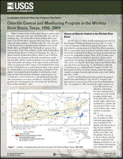
- Water resources of the Wichita River Basin in north-central Texas are vital to the water users in Wichita Falls, Tex., and surrounding areas. The Wichita River Basin includes three major forks of the Wichita River upstream from Lake Kemp, approximately 50 miles southwest of Wichita Falls, Tex. The main stem of the Wichita River is formed by the confluence of the North Wichita River and Middle Fork Wichita River upstream from Truscott Brine Lake. The confluence of the South Wichita River with the Wichita River is northwest of Seymour, Tex. (fig. 1). Waters from the Wichita River Basin, which is part of the Red River Basin, are characterized by high concentrations of chloride and other salinity-related constituents from salt springs and seeps (hereinafter salt springs) in the upper reaches of the basin. These salt springs have their origins in the Permian Period when the Texas Panhandle and western Oklahoma areas were covered by a broad shallow sea. Over geologic time, evaporation of the shallow seas resulted in the formation of salt deposits, which today are part of the geologic formations underlying the area. Groundwater in these formations is characterized by high chloride concentrations from these salt deposits, and some of this groundwater is discharged by the salt springs into the Wichita River.
- Survey Date
- 2011
- Print Date
- 2011
- Height In Inches
- 11.000
- Length In Inches
- 8.500
- Two Sided
- Yes
- Pieces
- 1
- Languages
- English
Related Items

Stream monitoring and educational program in the Red River Basin, Texas, 1996-97
Monitoring the water quality of the nation's large rivers; Columbia River Basin NASQAN Program