

Product Details
- Product Number
- 30738
- Series
- MF-1422
- Scale
- 1:48,000
- Alternate ID
- GMF1422D
- ISBN
- 978-0-607-81075-2
- Authors
- WIECZOREK, G. F.
- Version Date
- 01/01/1982
- Regions
- CA
- Countries
- USA
- Media
- Paper
- Format
- Folded
Additional Details
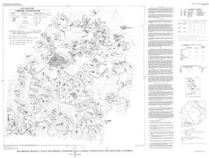
- Description
- Map showing recently active and dormant landslides near La Honda, central Santa Cruz Mountains, California
- Survey Date
- 1982
- Print Date
- 1984
- Boundary Type
- Quadrangle
- Two Sided
- No
- Pieces
- 1
- Languages
- English
Related Items

Map showing recently active breaks along the San Andreas Fault between the central Santa Cruz Mountains and the northern Gabilan Range, California

MAP SHOWING LOCATIONS OF DAMAGING LANDSLIDES IN SANTA CRUZ COUNTY, CA RESULTING FROM THE 1997-98 EL NINO RAINSTORMS