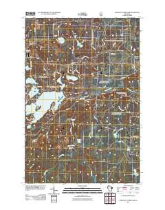
Product Details
- Product Number
- 264129
- Scale
- 1:24,000
- Version Date
- 01/01/1971
- Regions
- WI
- Countries
- USA
- Media
- Paper
- Format
- Flat
Additional Details
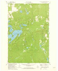
- Description
- UPPER EAU CLAIRE LAKE, WI HISTORICAL MAP GEOPDF 7.5X7.5 GRID 24000-SCALE 1971
- Survey Date
- 1971
- Print Date
- 1985
- Height In Inches
- 27.400
- Length In Inches
- 22.000
- Boundary Type
- Quadrangle
- Pieces
- 1
Related Items
UPPER EAU CLAIRE LAKE, WI HISTORICAL MAP GEOPDF 7.5X7.5 GRID 24000-SCALE 1971