


Product Details
- Product Number
- 224939
- Series
- DS-470
- Scale
- NO SCALE
- Alternate ID
- DS470
- ISBN
- 978-1-4113-2613-2
- Authors
- REISS, THOMAS
- Version Date
- 01/01/2009
- Regions
- LA
- Countries
- USA
- Media
- Electronic (Physical)
- Format
- CD-ROM
Additional Details
- Description
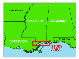
- 12/22/2009 Abstract Hurricane Katrina made landfall with the northern Gulf Coast on August 29, 2005, as one of the strongest hurricanes on record. The storm damage incurred in Louisiana included a number of levee failures that led to the inundation of approximately 85 percent of the metropolitan New Orleans area. Whereas extreme levels of storm damage were expected from such an event, the catastrophic failure of the New Orleans levees prompted a quick mobilization of engineering experts to assess why and how particular levees failed. As part of this mobilization, civil engineering members of the United States Geological Survey (USGS) performed terrestrial lidar topographic surveys at major levee failures in the New Orleans area. The focus of the terrestrial lidar effort was to obtain precise measurements of the ground surface to map soil displacements at each levee site, the nonuniformity of levee height freeboard, depth of erosion where scour occurred, and distress in structures at incipient failure. In total, we investigated eight sites in the New Orleans region, including both earth and concrete floodwall levee breaks. The datasets extend from the 17th Street Canal in the Orleans East Bank area to the intersection of the Gulf Intracoastal Waterway (GIWW) with the Mississippi River Gulf Outlet (MRGO) in the New Orleans East area. The lidar scan data consists of electronic files containing millions of surveyed points. These points characterize the topography of each levee's postfailure or incipient condition and are available for download through online hyperlinks. The data serve as a permanent archive of the catastrophic damage of Hurricane Katrina on the levee systems of New Orleans. Complete details of the data collection, processing, and georeferencing methodologies are provided in this report to assist in the visualization and analysis of the data by future users.
- Survey Date
- 2009
- Print Date
- 2009
- Height In Inches
- 5.000
- Width In Inches
- 0.250
- Length In Inches
- 5.500
- Two Sided
- No
- Pieces
- 1
- Languages
- English
Related Items
Archive of post-Hurricane Charley Coastal Oblique Aerial Photographs Collected during U.S. Geological Survey Field Activity 04CCH01 from Marco Island to Fort DeSoto, Florida, August 15, 2004
Archive of Digital Chirp Seismic Reflection Data Collected During USGS Cruise 05SCC01 Offshore of Port Fourchon and Timbalier Bay, Louisiana, August 2005
Archive of Digitized Analog Boomer Seismic Reflection Data Collected from Lake Pontchartrain, Louisiana to Mobile Bay, Alabama, During Cruises Onboard the R/V ERDA-1, June and August, 1992