Product Details
- Product Number
- 212607
- Series
- SIR-2009-5032
- Scale
- NO SCALE
- Alternate ID
- SIR2009-5032
- ISBN
- 978-1-4113-2367-4
- Authors
- MARK BECKER F
- Version Date
- 01/01/2009
- Regions
- OK
- Countries
- USA
- Media
- Paper
- Format
- Bound
Additional Details
- Description
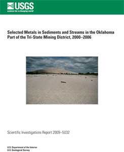
- 7/22/2009 Abstract The abandoned Tri-State mining district includes 1,188 square miles in northeastern Oklahoma, southeastern Kansas, and southwestern Missouri. The most productive part of the Tri-State mining district was the 40- square mile part in Oklahoma, commonly referred to as 'the Picher mining district' in north-central Ottawa County, Oklahoma. The Oklahoma part of the Tri-State mining district was a primary producing area of lead and zinc in the United States during the first half of the 20th century. Sulfide minerals of cadmium, iron, lead, and zinc that remained in flooded underground mine workings and in mine tailings on the land surface oxidized and dissolved with time, forming a variety of oxide, hydroxide, and hydroxycarbonate metallic minerals on the land surface and in streams that drain the district. Metals in water and sediments in streams draining the mining district can potentially impair the habitat and health of many forms of aquatic and terrestrial life. Lakebed, streambed and floodplain sediments and/or stream water were sampled at 30 sites in the Oklahoma part of the Tri-State mining district by the U.S. Geological Survey and the Oklahoma Department of Environmental Quality from 2000 to 2006 in cooperation with the U.S. Environmental Protection Agency, and the Quapaw and Seneca-Cayuga Tribes of Oklahoma. Aluminum and iron concentrations of several thousand milligrams per kilogram were measured in sediments collected from the upstream end of Grand Lake O' the Cherokees. Manganese and zinc concentrations in those sediments were several hundred milligrams per kilogram. Lead and cadmium concentrations in those sediments were about 10 percent and 0.1 percent of zinc concentrations, respectively. Sediment cores collected in a transect across the floodplain of Tar Creek near Miami, Oklahoma, in 2004 had similar or greater concentrations of those metals than sediment cores collected at the upstream end of Grand Lake O' the Cherokees. The greatest concentrations of cadmium, iron, lead, and zinc were detected in sediments beneath an intermittent tributary to Tar Creek, a slough which drains mined areas near Commerce, Oklahoma. In surface water, aluminum and iron concentrations were greatest in the Neosho River, perhaps a result of runoff from areas underlain by shales. The greatest aqueous concentrations of cadmium, lead, manganese, and zinc were measured in water from Tar Creek, the primary small stream draining the Picher mining district with the largest proportion of mined area. Water from the Spring River had greater zinc concentrations than water from the Neosho River, perhaps as a result of a greater proportion of mined area in the Spring River Basin. Dissolved metals concentrations were generally much less than total metals concentrations, except for manganese and zinc at sites on Tar Creek, where seepage of ground water from the mine workings, saturated mine tailings, and/or metalliferous streambed sediments may be sources of these dissolved metals. Iron and lead concentrations generally decreased with increasing streamflow in upstream reaches of Tar Creek, indicating dilution of metals-rich ground water by runoff. Farther downstream in Tar Creek, and in the Neosho and Spring Rivers, metals concentrations tended to increase with increasing streamflow, indicating that most metals in these parts of these streams were associated with runoff and re-suspension of metals precipitated as oxide, hydroxide, and hydroxycarbonate minerals on land surface and streambeds. Estimated total aluminum, cadmium, iron, manganese, and zinc loads generally were greatest in water from the Neosho and Spring Rivers, primarily because of comparatively large streamflows in those rivers. Slight increases in metal loads in the downstream directions on those rivers indicated contributions of metals from inflows of small tributaries such as Tar Creek and from runoff.
- Survey Date
- 2009
- Print Date
- 2009
- Height In Inches
- 11.000
- Width In Inches
- 0.200
- Length In Inches
- 8.500
- Two Sided
- Yes
- Pieces
- 1
- Languages
- English
Related Items


