Product Details
- Product Number
- 212601
- Series
- SIR-2009-5110
- Scale
- NO SCALE
- Alternate ID
- SIR2009-5110
- ISBN
- 978-1-4113-2485-5
- Authors
- MICHAEL LANGLAND J
- Version Date
- 01/01/2009
- Regions
- PA
- Countries
- USA
- Media
- Paper
- Format
- Bound
Additional Details
- Description
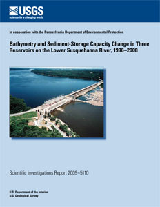
- 7/20/2009 Abstract The Susquehanna River transports a substantial amount of the sediment and nutrient load to the Chesapeake Bay. Upstream of the bay, three large dams and their associated reservoirs trap a large amount of the transported sediment and associated nutrients. During the fall of 2008, the U.S. Geological Survey in cooperation with the Pennsylvania Department of Environmental Protection completed bathymetric surveys of three reservoirs on the lower Susquehanna River to provide an estimate of the remaining sediment-storage capacity. Previous studies indicated the upper two reservoirs were in equilibrium with long-term sediment storage; only the most downstream reservoir retained capacity to trap sediments. A differential global positioning system (DGPS) instrument was used to provide the corresponding coordinate position. Bathymetry data were collected using a single beam 210 kHz (kilohertz) echo sounder at pre-defined transects that matched previous surveys. Final horizontal (X and Y) and vertical (Z) coordinates of the geographic positions and depth to bottom were used to create bathymetric maps of the reservoirs. Results indicated that from 1996 to 2008 about 14,700,000 tons of sediment were deposited in the three reservoirs with the majority (12,000,000 tons) being deposited in Conowingo Reservoir. Approximately 20,000 acre-feet or 30,000,000 tons of remaining storage capacity is available in Conowingo Reservoir. At current transport (3,000,000 tons per year) and deposition (2,000,000 tons per year) rates and with no occurrence of major scour events due to floods, the remaining capacity may be filled in 15 to 20 years. Once the remaining sediment-storage capacity in the reservoirs is filled, sediment and associated phosphorus loads entering the Chesapeake Bay are expected to increase.
- Survey Date
- 2009
- Print Date
- 2009
- Height In Inches
- 11.000
- Width In Inches
- 0.200
- Length In Inches
- 8.500
- Two Sided
- Yes
- Pieces
- 1
- Languages
- English
Related Items


