

Product Details
- Product Number
- 209192
- Series
- OFR-2007-1403
- Scale
- 1:24,000
- Alternate ID
- 071403
- Authors
- KARL S KELLOGG
- Version Date
- 01/01/2007
- Regions
- CA
- Countries
- USA
- Media
- Paper
- Format
- Flat
Additional Details
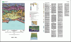
- Description
- The Goleta quadrangle is located in the western Transverse Ranges physiographic province along an east-west-trending segment of the southern California coastline about 100 km (62 mi) northwest of Los Angeles. The Santa Barbara coastal plain surface, which spans the central part of the quadrangle, includes several mesas and hills that are geomorphic expressions of underlying, potentially active folds and partly buried oblique and reverse faults of the Santa Barbara fold and fault belt (SBFFB). Strong earthquakes have occurred offshore within 10 km of the Santa Barbara coastal plain in 1925 (6.3 magnitude), 1941 (5.5 magnitude) and 1978 (5.1 magnitude). These and numerous smaller seismic events located beneath and offshore of the coastal plain, likely occurred on reverse-oblique-slip faults that are similar to, or continuous with, Quaternary reverse faults crossing the coastal plain. Thus, faults of the SBFFB pose a significant earthquake hazard to the approximately 200,000 people living within the major coastal population centers of Santa Barbara and Goleta. In addition, numerous Quaternary landslide deposits along the steep southern flank of the Santa Ynez Mountains indicate the potential for continued slope failures and mass movements in developed areas. Folded, faulted, and fractured sedimentary rocks in the subsurface of the coastal plain and adjacent Santa Barbara Channel are sources and form reservoirs for economic deposits of oil and gas, some of which are currently being extracted offshore. Shallow, localized sedimentary aquifers underlying the coastal plain provide limited amounts of water for the urban areas, but the quality of some of this groundwater is compromised by coastal salt-water contamination. The present map compilation provides a set of uniform geologic digital coverages that can be used for analysis and interpretation of these and other geologic hazards and resources in the Goleta region.
- Height In Inches
- 36.000
- Length In Inches
- 60.000
- Pieces
- 1
Related Items

Preliminary geologic map of the Santa Barbara coastal plain area, Santa Barbara County, California
Preliminary Geologic Map of the Lake Mead 30' X 60' Quadrangle, Clark County, Nevada, and Mohave County, Arizona <p> <p> Prepared in cooperation with the National Park Service
Geologic map of Santa Cruz County, California, a digital database